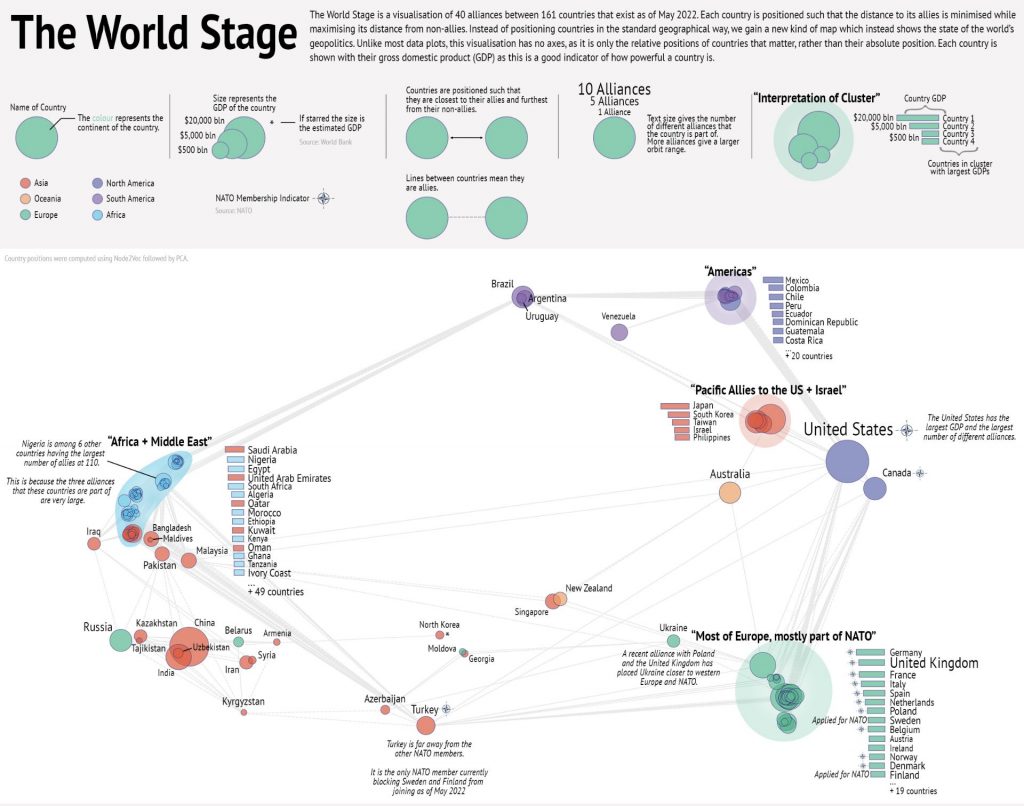
Congratulations to Ed Davis who won a poster award as part of the Jean Golding Institute’s Beauty of Data competition.
This visualisation, entitled “The World Stage”, gives a new way of representing the positions of countries. Instead of placing them based on their geographical position, they have been placed based on their geopolitical alliances. Countries have been placed such to minimise the distance to their allies and maximise the distance to their non-allies based on 40 different alliances involving 161 countries. This representation was achieved by embedding the alliance network using Node2Vec, followed by principal component analysis (PCA) to reduce it to 2D.


